Fifteen minutes past midnight I woke to a racing heartbeat, as if I had been running, and my breathing was quick and shallow.
It was a little frightening, but I remembered those things are side effects of altitude and it is normal to feel some symptoms.
I was extremely thirsty, so I drank as much water as I had available – a little less than a liter.
When my watch alarm started beeping at 6:15, Sam and I compared how we’d fared during the night: he said he’d had strange dreams, which is unusual for him.
 |
| Day 5 |
We hurriedly packed and went to the dining room, so the cook would start our breakfast order. I had another mushroom pizza, since the one last night was so tasty – it cost 400 rupee, which is spendy, but not surprising, since I’d read that things start to get more expensive from here on up the trail. It makes sense, since it takes more effort to get supplies further into the valley. While we waited, I purified the water in my bottle and a little girl, maybe 4 years old, who was hanging around the kitchen came to watch me. She was super shy and slowly maneuvered her way over to the table where I was sitting, quietly moving a step at a time, until her little eyes were peering over the table at my task. I showed her how I used the salt and shook my device to make the bleach and then poured it into my bottle full of slightly yellow water. It is a tedious process and I think Sam’s ultraviolet light purifier is much easier to use and we don’t have to wait 30 minutes to drink the water. The cook, a large, matronly, red-faced woman, poked her head out of the kitchen door and snapped for the girl to stop bothering the guests and get back in the kitchen (of course this was all stated in Nepali, but it was pretty obvious what she was saying).
After saying goodbye to our friends, who were just arriving for breakfast, we started walking through the village as it was gearing up for the day and men were headed out of town on whatever commute Chame residents find necessary. It was a rather chilly morning. We got stuck behind a heavily loaded donkey train, but managed to squeeze ahead of the doleful group as they got organized to cross the flag festooned suspension bridge. Apparently donkeys aren’t too keen on crossing wire bridges.
 |
| Traffic jam. |
 |
| Donkeys everywhere! |
 |
| The bridge |
 |
| Not sure what's going on with this rock shrine thing, but it's neat. |
There was a high trail that paralleled the road, but at a higher elevation. This trail led us through a luscious brown and green pine forest. All throughout the woods was evidence of how the locals harvest their lumber: a tree would be partially chopped with an axe, then a fire would be started at its base to burn through more of the base of the tree, and finally the tree would be left to fall of its own accord or chopped the rest of the way down at a later date. Dozens of these partially butchered trees were scattered throughout the woods. Also strewn amongst the trees were cows; they didn’t care about us at all, so we walked around them and beside them in mutual geniality.
 |
| Woodland cows |
 |
| Arbor-like structures at several points along the trail. Some had logs placed on top. Maybe drying racks? |
Farther along, the trail left the pleasant pine scented forest with its soft needle path and quiet peaceful atmosphere and rejoined the road. Fortunately, our road trek was short-lived after we passed through a small village and we happily left the road just as it was becoming congested with commuters and groups of trekkers with their guides and porters. Then we found ourselves in a pattern of wooden bridges, pine forests, and amazing mountain views. We met up with the nice guy from Indonesia who was paused at the second bridge in mid-assessment of its sturdiness. It held us, of course, and we continued along the very rocky trail that led back into another patch of woods containing snow instead of cows. The views of the mountains were incredible behind us and I attempted to walk backwards for a time, because it felt wrong to have such glorious hulks behind us and not be able to admire them as we plodded along the trail. I say plodded, because it grew very steep and I desperately needed to use a bathroom. Mercifully, at 11:30am, there was a village and I made a beeline for the first teahouse’s outhouse, trying not to make eye contact with the owner or the many trekker guests out on the patio sitting down to their lunch.
 |
| First bridge |
 |
| That waterfall! |
 |
| More pine forest |
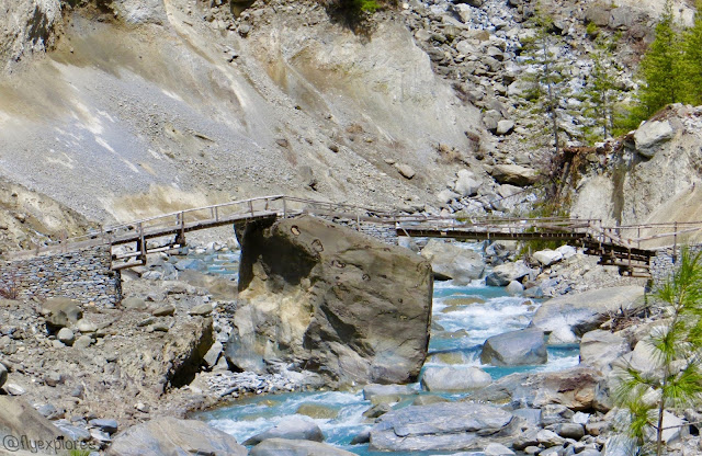 |
| Second bridge. Safe, right? |
 |
| Having fun and enjoying life! |
Relieved, we continued on through the village, but stopped at the very edge of it when we came across the Brit who was sitting in the shade of a teahouse. We chatted for a bit about how our treks were going; as we were talking, the Brit got out his sunscreen, flicked the cap open, and it suddenly burst an exorbitant amount of sunscreen all over him. He was covered. From face to knees, the thick, white, cream, was all over his torso and the look on his face was one of utter shock. We all just stood there in silence for a few seconds – he with his hand still outstretched and coated in sunscreen and Sam and I with our mouths agape in surprise. Then, Sam and I burst into peals of laughter and I had to gasp for air. The poor Brit resignedly began to scrape the cream off the front of his shirt and try to spread what was already on his face and arms around on his exposed skin. He offered us some from his shirt and we all three liberally coated our faces, necks, arms, and hands until we were all white. There was still an abundant amount of the stuff on his shirt and pants and he said to me, “You might want to turn around” and then began to unbuckle his pants. I immediately pivoted so I was facing away from the town and the stripping man and Sam, but we continued to chat. We all now know that altitude causes tubes of sunscreen (and probably toothpaste) to be pressurized. I honestly can’t remember what else we talked about, because I could only think of what was going on behind me. Imagine the scene with me: we were standing beside a teahouse on the edge of the village, there were dozens of trekkers sitting outside having lunch throughout the one-lane village, and there was the Brit standing next to the trail with his pants around his ankles, smearing copious amounts of sunscreen on his legs, chatting with us as casually as if nothing was unusual at all.
 |
| We're on the right path. |
Eventually, Sam and I left the Brit doing sunscreen cleanup and we walked until hunger stopped us under a pine tree for a snicker bar lunch. We then continued along the meandering trail and climbed, literally, up to Upper Pisang around 2:00pm. We met a group of female trekkers sitting in the sunshine, just past a long set of prayer wheels. One of them had a headache and they were debating whether or not they should continue, remain, or drop down to Lower Pisang. Two of them needed to use the bathroom, as did I, but the toilet was locked. So we ventured up a rock pile and around behind some stone buildings and enjoyed, as one of the girls put it, “a bit of privacy, except for a cow.” Back with the patiently waiting Sam, I spun the prayer wheels and then turned around to take in the most magnificent view of Annapurna II. It was so large and looming and beautiful I couldn’t stop looking at it. We reapplied sunscreen, being careful how the tube was opened. I should mention, Sam got pretty sunburned yesterday because he wasn't wearing sunscreen - he didn't think to bring any of his own - and had forgotten how harsh the sun can be. I practically bathe in sunscreen everyday, so I have avoided getting burned thus far.
At 2:45pm we crossed a little bridge and reached the base of the intimidating hill for Ghermu. Seriously, it was a beast of a hill, with switchbacks that ascended into oblivion. To steel ourselves for the task, we took a little snack break and met up with some of our trail buddies as they came up the trail behind us. Then, at 3:00pm we began the ascension. Sam left me shortly after we began, because I climb so slowly. I steadily progressed back and forth up the mountain, only stopping once to pee behind a scraggily bush, and kept passing and being passed by the Indonesian guy: he would pass me, then stop to take a break and I would pass him, and then he would catch up and pass me again – eventually we grew tired of saying hello and were out of breath anyway from our task, so we devolved to mere grunts of acknowledgement. I ran out of water two-thirds of the way up and became exceedingly thirsty. Finally, desperately, exactly one hour after I started the climb, I crested the top of the hill and there sat Sam. I desperately hoped he had some water for me, but he was packless, so I was led, sullenly, through Ghermu as it began to rain, to a strange teahouse where Sam had gotten a room for us.
Our innkeeper looked like he had a thousand years worth of ancestors from Mongolia; his attire suggested he had time traveled from there merely seconds before I met him.
His teahouse was equally fascinating.
Unfortunately, I was so peaked and altitude-addled to have enough presence of mind to take a photo of him or his teahouse.
I regret it very much.
The building can best be described by imagining a Viking lodge.
Seriously, google
Borgund Stave Church and you will have a near perfect match.
It was completely made out of wooden beams and planks and was very dark.
There was a central room with a large open flame wood stove in the very center and rooms radiating out from the main one.
Smoke smudge from countless years of fires coated the walls.
The ceiling was three stories up, so the square room felt larger than it was and a person could look up and see the balconies of the other two floors above them.
The staircase was across the room, at the back, and we stepped and creaked our way up to the top floor, traversed the balcony, tried to not look down at the smoky stove, and followed a dark and narrow passageway to our corner attic room with a sloping roofline. I immediately loved the room, threw down my pack, and emptied Sam’s water bottle.
However, after pulling out my sleeping bag, we realized it was only 4:30pm and we could possibly make it to Ngawal to spend the night. My desire to get there was fueled by the “climb high, sleep low” practice and Ngawal is at a lower altitude than Ghermu. So, my thirst quenched, we repacked and cautiously navigated our way back down the stairs to find the proprietor and tell him we were leaving. We found him in a sort of men’s smoking room, filled with other similarly dressed men of various ages and stages of antiquity. They were smoking pipes. Apologies and explanations were attempted in mime and charade format and then we stumbled out of the dark and smoke-filled doorway.
Up the alley, we found a community water pump, filled our bottles, and entertained a group of children by our ultraviolet-light water purification ritual. It began to snow as we stuffed our bottles into our packs and the few remaining women still out on the muddy lane frowned at us, as if they disagreed with our decision to press on to another village at that late hour and in the inclement weather. I started to have foreboding thoughts myself, but desperately wanted to sleep at a lower altitude. Sam gave me an encouraging nod and we set out through the narrow mud alley, through the village, and through the falling snow. The temperature dropped and the snow increased and the clouds blocked what little light remained, so we were hiking in very low light; the clouds also obscured our view, which was unnerving because the trail had a sharp dropoff to unknown depths on our left side and our right side was hemmed in by the flank of the mountain, but we could see neither the left nor the right. It got colder. We walked faster. Then came thunderous booms that rolled up and down the valley on our left and repeated themselves with ominous tones. It was difficult to tell if they were actual storm thunder or avalanches. I didn’t relish the thought of either one and we didn’t stop to figure it out there, alone, on the trail. The only two times we did stop were potty stops: one for Sam and one for me. I got hungry and ate a cliff bar – holding it with both my hands and nibbling at it like a squirrel. The evening was crazy. We practically started running when we rounded a bend and saw Ngawal in the distance. I was so relieved.
 |
| My one and only photo after Pisang. Adding insult to injury: tired and hiking through thorny barberry bushes. This is my "are you kidding me" face. |
We then roamed the stone village until we found a teahouse that had owners who were still open at the late hour of 6:00pm.
They showed us a second floor, corner room at the end of a stone hallway, pointed to the bathroom across the hall, and then made us understand that we could have dinner cooked if we wanted.
We did.
I sat down on my bed and nearly burst into tears, I was so tired and stressed about the possibility of not making it to the village, but I composed myself, not wanting to be a weakling, and we set up our beds and headed downstairs to order and eat dinner.
 |
| Sam is happy to have made it to Ngawal |
I brought my headlamp, just in case, and my journal, so I could write while dinner was being cooked.
It was a good thing, about the headlight, because the power did indeed go out, did not return, and we were left sitting in complete and utter darkness.
One of the owners came, after some minutes, with a lantern and set it on the table for us and not long after that our dinner arrived as well.
The lantern is more blinding than helpful and I’m not completely sure what I’m eating for dinner right now.
P.S. Today marks a change in the trek: it is the first day I have not been sore; also, I am feeling confident in our decisions and am now 'trail savvy' and feel less like a tourist and more like a part of Nepal.
Data:
Starting elevation: 8,694ft
Ending elevation: 12,007ft
Distance: 14.3 miles
Weather: moderate


