Sam woke me up at 5:00am because he was cold and wanted to leave. I was immediately awake and felt refreshed, so we packed our gear - I wore nearly every single article of clothing I had, so my pack was rather empty. On top, I had on my silk sleeping shirt, lightweight wool shirt, mid-weight polyester shirt, down jacket, and rain jacket; on bottom, I had on silk sleeping pants and mid-weight lined pants: the only leftover clothes not on my body was a spare pair of socks and my lightweight pants. Miraculously, I was able to flex and articulate my limbs and didn’t feel restricted in any way: a good thing because the Pass was reported to be technical and strenuous.
We were out the door by 5:50am and paused in the courtyard to take our daily photo. I was able to use my little tripod and wrapped it around the knob on the gate leading into the “greenhouse” dining room. A Nepali man stuck his head out to see what we were doing, we must have looked silly standing there, but he just shrugged his shoulders and pulled his head back inside the dark building, like a turtle retreating into its shell.
 |
| Day 10 |
Most trekkers had begun leaving at 2:00am, so we knew we were at the back of the pack, which was just fine for us. I didn’t want to feel rushed and was glad to not have to hike with other groups. We found that it had lightly snowed during the night, so the icy trail up to High Camp was more treacherous than it had been yesterday afternoon.
 |
| High Camp |
An hour later we reached High Camp, and headed inside the quiet teahouse for breakfast. My set breakfast of too sweet pancakes, cereal, a boiled egg and juice sat uneaten on my plate, because I found I had absolutely no appetite. Sam urged me to eat anyway, so I nibbled on the pancake before giving it to Sam to eat. I ordered some tea, hoping the hot buttery liquid would warm my body and when it arrived, I choked down the soft-boiled egg. It was pleasant, sitting there in front of floor-to-ceiling wraparound windows, taking in the panoramic views of the snow-covered mountains and watching the sun briefly glow far down the valley. Colored sunrises don’t seem to make it this deep into the mountains: there is a small, brief touch of color and then it disappears, replaced with plain old light. Sunsets have been even less noteworthy.

There was one couple, the French couple we trekked with on our way to Chame, eating breakfast in the dining room with us, so we knew they would be behind us during the climb, which was somehow comforting to know that we were not the very last trekkers of the day to try for the Pass summit. At 8:00am, we stepped out into the bitter cold and cutting wind to begin our snowy climb. We had to side-step around three heavily festooned, enormous yaks, who were resignedly displaying their flashy red tassels and blue and green saddles. These hairy beasts of burden are stationed here for rent by trekkers who do not want to, or cannot, climb the pass and wish to ride in state and pomp on a yak. This is a dangerous practice, because riding trekkers are less aware of the effects of the altitude on their bodies: trekkers have been known to reach the top of the pass and be found unconscious on the yak.
 |
| The water in my pack and drinking tube is already frozen in this photo. |
*Sorry, no photo of the ornamented yaks. A little voice in my head said, “Take a photo,” but the thinking part of my brain was succumbing to the altitude and I didn’t take a photo.
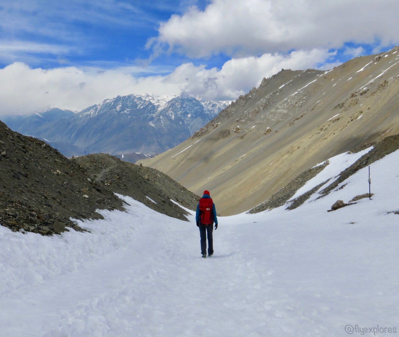
The clouds were low and snow began to fall not long after we started the long uphill trek. Snow was falling so thick it nearly obliterated the light and I contemplated getting out my headlight, but was too cold to stop and retrieve it from my pack. The wind also increased and was blowing with such force, Sam, who was ahead of me, could not hear me when I shouted to him. We were following the trail stomped into the snow by dozens of trekkers who had gone before us, but the trail was a mere single foot width; it made walking difficult, because the footpath was more like a narrow trench set into the deep snow, and my feet and legs fought for room as I walked. This trench-trail was carved in the side of the steep mountain, so steep that, in places, I could stretch out my arm at a right angle to my body and touch the side of the slope. I was exceedingly fearful – one wrong stumble and I could possibly fall several hundred feet or further: I couldn’t see the bottom of the slope. The cold air was so thin I couldn’t get enough into my lungs and developed side stiches, as if I’d been running.
 |
| Before things got steep - see the snow we are heading into up there. |
An entrepreneurial Nepali man had a tea-shop (imagine a rustic stable) about halfway up to the top of the pass and we eagerly ducked into his little stone shack and out of the wind to rest and regain our fortitude. It was not even remotely warm in there – the relentless wind chased any heat right out of the shelter through the gaps in the stacked stone walls and wooden rafters, howling menacingly as it did so. In an attempt to make the place comfortable, plush yak hides and other thick fur pelts were heaped on benches and over the single central table. Weak light was provided via a single, smoke smudged lantern. I was miserable in my fear of falling, fear of getting HACE (high altitude cerebral edema), and fear of frostbite that I didn’t want to stop: I just wanted to keep stoically trudging through the snow to reach the top of the pass. So, after chatting with the tea man, who told us his story of setting up his operation decades ago, how he didn’t make much money because most trekkers didn’t want to stop half way to the top, and how his adult children urged him to give up his daily commute up and down the mountain, but he liked the place too much to leave, we ourselves said ‘goodbye’ and left. It was disheartening to leave the relative shelter of the shack and return to the snow and wind, but after several minutes of travel, the snow gradually lessened and stopped altogether; the wind lessened as well.

My state of coldness did not diminish, however, so Sam removed his down jacket and put it on me (I had lost the use of my hands, despite wearing gloves), wrapping the empty arms around my body like a straightjacket; he then rigged my pack so it would stay on my body, even though my arms were not through the straps.
He, now only wearing his rain jacket, didn’t think I would be able to walk without the use of my arms for balance, but I did just fine and having my arms close to my body helped me generate body heat: I was warm and happy for the remainder of our climb (it was a good thing I didn’t fall, or I would have been as helpless as a worm).
 |
| Almost to the top. |
Three hours after our climb began and after a great many snowy false summits (I’d read there would be a lot of them), at 11:00am we did indeed reach the summit of Thorong La. Imagine my joy and relief at not being defeated by the altitude! Then, imagine my disappointment when we discovered the summit sign was buried under the snow. All the photos I had seen on the internet showed happy trekkers standing next to the summit sign, but that was not to be for me; someone had dug out a bit of the sign, so a small piece of it could be seen.
 |
| The summit sign and prayer flags. |
 |
| My "you have got to be kidding me" face. |
 |
| "Thank You For Visiting Manang Thorong La Pass" |
Then, post adrenalin rush, we peered about like lost souls: what were we to do now, where should we go – our goal had been accomplished. We picked up our packs, I was free from my straightjacket getup by this time, and headed for the lone tea-shop shack that was located a dozen yards from the buried sign and prayer flags, but it was cold and cramped in there, so we immediately returned to the wind. The French couple arrived then, so I took their summit picture for them and they took ours and then Sam and I began our descent. It was nice and gently sloping for a bit, but then the sun appeared and began to soften the snow, which made everything a soggy, slushy mess. We slipped and slid and fell our way down switchback after switchback, met up with a pack of other trekkers, and laughed and suffered along with them. The snow gave way to rocks and mud and the trail disappeared altogether, marked only by an occasional pole stuck in the ground at intervals; we fought our way from one pole to the next, pausing at each one to scan the slope below us, locate the next pole, and then set out for it.
 |
| Taking a break below some glaciers. |
 |
| Sam heads for a trail marker pole. |
 |
| Me, on the easy part. |
 |
| Gotta love those glaciers. |
 |
| Tiny trekkers in the snow - center of photo. |
 |
| Partial building |
 |
| The downhill is not as bad as the uphill. |
Finally, at 1:30pm, we made it below the snow and steep section and found a great many of our trekking friends celebrating at a teahouse nestled conveniently at the bottom of the steep trail: a perfect place to sit and recover after such an ordeal.
We did not sit and rest for long, because the place was packed full of raucous trekkers, only stopping long enough to use the outhouse, put our jackets and a few layers of clothing back in our packs, and dig out our final two snickers bars.
As a lunch substitute, after ascending nearly 3,000ft from Base Camp to Thorong La, an altitude of 17,769ft, and down the other side 5,597ft, my snicker bar was, truly, satisfying.
The Brit made his way over to us, offered his congratulations, and asked if we were headed down and if he could join us.
So, the three of us started down the rocky, undulating landscape, and passed the time sharing life stories as our bodies soaked up the warm sunshine and much needed oxygen.
 |
| Trekking through a pasture with scrawny ponies - how do they find enough to eat on this glacial moraine? |
 |
| Prayer flags festoon the mountainside near the enormous sacred Temple of Muktinath - sorry, no photo of that. |
 |
| Looking back up the mountainside we just descended. |
I felt like Wonder Woman as we trekked up and down hills and into the rocking town of Muktinath – my body loved the lower elevation and I felt as if I could run a marathon. We met Johnathan as he was stepping out of the Bob Marley hotel, expressed our surprise and joy at finding him again, and he fell into step with us down the stone paved, pedestrian only street. The Bob Marley hotel makes nightclubs look like naptime areas in preschool – music stampeded out through the swinging doors and reverberated from the windows and the building practically swayed and bounced to the rhythm. The rooms inside the building looked like mosh pits, chocked full of trekkers from all corners of the world, engaged in eating, drinking alcohol, singing, dancing, and shouting at each other, simultaneously.
 |
| Muktinath |

Desiring a teahouse with a more calming atmosphere, we made our way to the very opposite end of town and selected a teahouse that glowed in the sunshine. We were shown our rooms and unpacked. Sam left to find the showers and I joined the Brit out on the front steps where we sat and people watched. We watched the trekkers streaming down the street and he would periodically call out, “Germans! Those are Germans!” Upon my inquiry, he said he knew them by their walking sticks and the teahouses they chose: “Germans only stay in the ritzy places.” Oh. I don’t know how he judged the teahouses to be “ritzy” because they all seemed the same to me. Not long after that, my guide into the insights of cultural preferences left me in search of a place for dinner and Sam appeared to inform me that showers were not included in the price of the teahouse. Outraged, we packed up our stuff and moved to the teahouse across the street, where we were shown a room with softer beds and an attached shower/toilet. Ritzy.
That shower needed some maintenance attention, because the showerhead wouldn’t remain in place when the water was turned on, so I dug out the cord I had brought, not knowing what we might need it for (broken shoelaces or whatever) and Sam rigged up a fix for us. Then, freshly showered and relatively clean, we headed downstairs to the dining room and ate dinner: I had a Club sandwich, consisting of spam, yak cheese, fried egg, slice of tomato, and tuna between two thick slices of bread. It is now 7:30pm. A dog is barking, but I have my earplugs and am so exhausted, I expect to sleep soundly throughout the night.
 |
| Rigging the shower so it will stay in place. |
 |
| The overhead spigot didn't work, only the wand. This held if from falling off the wall. |
 |
| Me, drinking tea in bed. |
Data
Starting elevation: 14,895ft
Highest elevation: 17,769ft
Ending elevation: 12,172ft
Distance: 10.1 miles
Weather: extreme